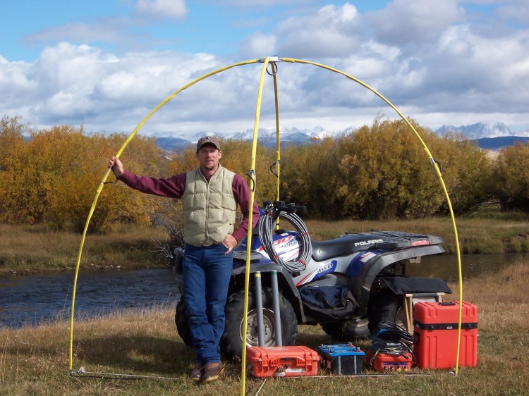
(910
Telluric Technologies has a wide-range of experiences in the Western Hemisphere. Not only have we successfully evaluated oil and gas projects with our MT systems in 37 states in the United States and offshore in the Gulf of Mexico, but we also have had the privilege to contribute to international projects in Canada, Mexico, Australia, and South America.
In the coal industry, our environmentally-friendly equipment can be backpacked into nearly-inaccessible areas for data acquisition to help determine coal thickness variations due to depositional variation or channel-cuts, coal structure, and fault-delineation/offset footage. Our clients include several of the largest coal companies in the USA.
The MT1 geophysical survey system was developed in 1990 to successfully determine the geological conditions from ground level to 20,000 feet. The Mt1 is a field-portable data-acquisition system which allows an operator to capture the desired data, store it on a digital medium, and transport the data to our offices for processing. The data is presented in a two-fold format which provides a T-Log (telluric curve/apparent resistivity) and a fluid signature at each horizon where porosity and permeability are indicated.
Magnetotelluric theory states that the earth is enveloped in an electromagnetic (EM) field primarily caused by solar radiation which interatcs with Earth's outer ionosphere. This produces EM wave-fronts which penetrate into the earth until they pass through a change in resistivity/conductivity caused by a change in lithology, porosity, or mineral composition. These resistivity interfaces propagates a new EM pulse which radiates to the surface and is available for capture and processing.
These widespread EM fields have frequencies which penetrate the earth to depths which are defined by Maxwell's Skin Depth Equation:
. Longer wavelengths penetrate to deeper depths, interact with variances in the formation resistivities, and return data to the surface which allows us to view the changes in the resistivity (inverse conductivity) at each skin depth. The presence of porosity and fluids or gas in the subsurface produces a secondary signal which is imprinted upon the carrier wave, allowing us to identify potential oil and gas accumulations. The hydrocarbon-type fluid signature has different characteristics than a salt-water fluid signature due to different magnetic resonance, enabling the differentiation of fluid types within porous and permeable horizons.
When surveying, MT1 data is collected at control wells to calibrate the MT1 depth and formation responses for each objective marker bed or potentially-productive horizon. The calibrations serve as a structural and reservoir benchmark for comparison to other exploratory MT1 stations. Correlating the T-Logs to these calibration wells allows an accurate determination of the local structure and stratigraphy of objective formations. The data can be used to help determine formation lithology, relative porosity/permeability, structure, faulting, and isopach thicknesses.
Our MT1 system has led to the discovery of over 100 million barrels of oil in the continental United States and Australia. We have conducted surveys in 37 states from New York to California. Our system has been utilized heavily in the Midcontinent region, but we also have widespread experience in the Gulf Coast, Black Warror Basin, Illinois Basin, Gulf of Mexico (subsalt play), Australia, Canada, Mexico, and South America.
In addition, we have extensive experience working on large mine projects in every major coal district in the United States. Our coal clients range from the largest public coal companies to the smallest private coal miners.
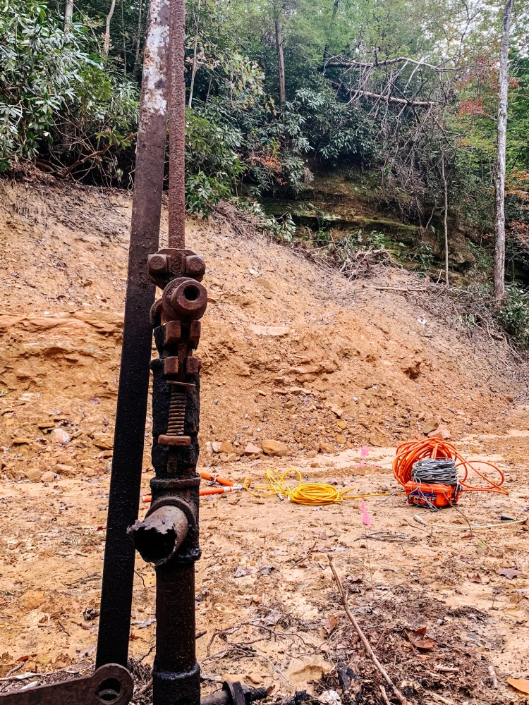
Telluric Technologies is pleased to announce the implementation of the most advanced underground resistivity mapping system available today. Our hybrid-sourced magnetotelluric MT-2D system is the first portable subsurface resistivity imaging equipment that allows a high-resolution view of the subsurface from ground level to a mile deep. The data generated is used in a variety of applications where subsurface resistivity measurements are of interest. These include projets seeking to identify oil and gas, coal bed methane, coal seam thickness and structure, fault orientations and throws, minerals, engineering studies, structural mapping, isopach intervals, void detection, and environmental site characterization.
Oil and gas projects can be surveyed and evaluated in a very short time with no environmental impact. Shallow coal, oil and gas prospects (above 1500 feet) can be identified with our 2-Dimensional Plot . Not only can the objective zone be identified with both systems, but the overburden can be viewed to determine depths and areas where there may be significant drilling challenges such as thick fresh-water zones, voids, or faulting. With the MT-2D's ability to adjust the plots for changes in the ground level, true sea-level structural cross-sections can be viewed within minutes of completion of the field acquisition. Small or large faults can even be detected and displacements determined by correlations of the data. A thermal printer allows immediate changes in the field survey, allowing for high flexibility in the survey design. The final data format is a color-coded and layered resistivity cross-section (as shown on the lbottom left).
Older magnetotelluric instruments were expensive, difficult to apply, cumbersome and limited to deep investigations, but our new system is more mobile and uses both natural and controlled source EM (electromagnetic) fields by working principally in the high-frequency domain. This allows accurate resistivity measurements over a wide range of depths. Also, by allowing a field printout of the subsurface resistivity map, we can provide more detailed field information than any other subsurface resistivity of conductivity technique available today. This improves our turn-around time and lowers the survey costs. Our antenna, processor, and sensors (shown on the top right) are small and can easily be transported and set up in the field. Data from up to 20 sites can be gathered, rinted, and evaluated in one day. The data is presented either in a 2-D or 3-D cross-section view in the field, allowing a "layer cake" look at the rock or sediment layers below.
The biggest advantage of the MT-2D magnetotelluric equipment is that the equipment and survey crew do no environmental damage. The equipment is simply placed on the ground and five small stakes (about the size of tent stakes) are inserted into the ground to a depth of approximately 3-4 inches. The data can be processed in the field for immediate two-dimensional stratigraphic viewing.
HOW IT WORKS
Our MT-2D system operates and images the subsurface by utilizing certain electromagnetic frequency ranges (10 Hz to 100 kHz) that can penetrate the ground. Many of those frequencies naturally occur in the earth's electromagnetic envelope, enabling us to image depths up to a mile deep.
The natural field is primarily sourced by solar activity, thunderstorms, and manmade electromagnetic fields from sources such as powerlines. Occasionally, the natural signals are not available at the time, frequency, and amplitudes needed. We can now fill in frequency gaps in the natural field (>1000 Hz) with the use of a small transmitter, enabling continuous data from the ground level downward. The actualvalues measured at each survey site are the variances in the resistivity values of the soil and rocks below. Changes in the resistivity data enable the differentiation of rock types and the fluids contained within the pore spaces of a permeable reservoir.
The utilized frequencies that penetrate the ground are limited in depth by their wavelengths. The longer wavelength frequencies (low-frequency) can penetrate to the greatest depths, enabling us to map geological conditions with high definition. The higher frequencies allow shallow earth modeling. Utilizing both low and high frequencies allow us to continuously image the resistivity values of the formations below and correlate the corresponding layers in a computer-generated 2-Dimensional or 1-Dimensional format. Our geologists are then able to interpret and identify the geological conditions that underlie a property.
Twenty-eight years of experience in multiple industries has given us the opportunity to become a leader in telluric geophysical services. We provide services to all exploration industries including oil and gas, coal, potable water for irrigation or municipal usage, economic minerals, geothermal energy, and archaeology. Our geologists and geophysical methods have been responsible for the discovery of over 100 million barrels of oil, numerous tons of new coal reserves, and countless gallons of fresh water supplies. In all industries, our mission is to provide a detailed view of the subsurface via our MT methods and geological/geophysical expertise so that our clients can make informed decisions when exploring.
One capability that makes Telluric Technologies unique amongst other companies is our ability to utilize a unique signature to help differentiate formation fluids (i.e., oil vs. water). Finding an oil-water contact or formation fluid types can be achieved by evaluating our "fluid signatures." This secondary signature exists because the EM source-field sends a time-variant signal into the earth which causes a Magnetic Resonance Signature (MRS) within porous and permeable formations. The MRS varies in its characteristics and patterns in a hydrocarbon-bearing zone. It is not typically affected by the connate water within the formation, but is directly related to the interconnected areas of porosity along the permeable pathways.
This resonance creates unique secondary signals which are captured, processed, and analyzed to provide fluid-type interpretations, relative porosity levels, and fluid column thicknesses (pay zone thickness). Our clients utilize this unique capability to identify areas which are optimal drill sites, and also as a way to high-grade locations to help avoid drilling wells in areas with no hydrocarbon signatures within the objective formations. We have logged tremendous success utilizing the MT fluid signature, resulting in the discovery of millions of barrels of oil and gas in the U.S. A. and Canada.
In coal exploration, we have used this signature to help identify the differences between coal and sandstone units. This has helped us differentiate where coals have been eroded and replaced by sandstone channels. We can use this differentiation to identify potentially-faulted areas and determine displacements through the correlation of the Telluirc T-Logs. In 2010, Telluric entered into a R&D project with a major coal company to determine if the data can be utilized to differentiate areas where the coal had been burned. The preliminary information was highly positive due to the changes in not only the T-Log, but also the differences in the MRS in the coal-burn area.
We are a Geophysical Service company servicing the oil, gas, and coal exploration industries. Geophysical methods include magnetotelluric geopysical methods.
With over 28 years of experience, Telluric Technologies has defined geological projects in the USA, Mexico, Canada, South America and Australia. Our portable MT1 natural-sourced and our other hybrid-sourced magnetotelluric systems have excellent application in the oil and gas industry to identify the fluid-type (oil, gas, water) in porous reservoirs, determine zone thickness, and map the structural orientation of the marker beds.
Kevin Rigsby,
President/ Geologist
Biography
Kevin graduated from Oklahoma State University in 1985 with a Bachelor of Science in Geology. He has more than 28 years experience in geological and geophysical prospecting utilizing magnetotelluric, electrotelluric, and other geophysical methods. His focus has been in oil, gas, and coal exploration, but he also has extensive geological and geophysical experience with groundwater and economic minerals projects.
Professional History
From 1984-1989 Kevin worked as a field Geologist and Geophysical Trainer with Geophysical International, Inc. In 1990 he was employed as a Prospect Geologist and Telluric Geophysical Analyst at Santa Rita Resources Company. In 1992 he founded Telluric Technologies, and is now the President, and majority share owner. He also founded StrataTek Groundwater Imaging in 2000, which was acquired by Hydro Resources in 2004. He is now the Geological Manager of the Groundwater Geophysics Department at Hydro Resources.
Professional Affiliations
Significant oil and gas discoveries and developments include the State Line Field (Morrow SS) on the Colorado/ Kansas border and the Navigator Field (Tannehill SS) in Dickens County, TX.
One of our fastest-growing applications is within the coal industry. Our coal company clients are utilizing our MT geophysics at an ever-increasing rate, creating the need to add additional crews to evaluate the structure, coal thickness, and stratigraphic variations in coal seams ranging from 2 feet thick to over 90 feet thick. Our data can help identify faults (and their offsets), sandstone channel coal-erosion, coal burn, and potential hazards in mined areas.
We are currently working in nearly every coal region in the United States, but our areas of greatest expertise are generally located in Montana, Wyoming, Utah, Colorado, and West Virginia. Our customers currently use our data for fault-delineation and coal thickness. With our continuous data sweeps, we can provide a T-log of the subsurface on a foot-by-foot basis. Our MT1 T-Logs closely resemble borehole geophysical logs such as a resistivity log, which helps the company geologist correlate the MT data at each sounding point to nearby down-hole logs and boreholes. With these correlations, we can note areas of unusual structural variation, coal thickening/thinning, and potential coal-bed erosion due to a down-cutting channel system.
Main office:
Geophysical Resource Center
8801 S. Yale Ave.
Ste. 401
Tulsa, OK 74137
Phone: 1 (918) 496-TELL (8355)
Alternate Phone: 1 (918) 284-2996
Fax: 1 (918) 496-8382
Kevin Rigsby, Owner / President
For International Calls:
+0011 19182842996
Call us Today:
1 (918) 284-2996